
Updated: 12/27/2022: Discovered that I was using the kilometer measure for the bridge distance. In miles it measures 17.6 miles point to point. mea culpa.
Virginia has a rather unique item of interest in the area of the Hampton Roads known as the Chesapeake Bay Bridge Tunnel. Of course, in this area there are a substantial item of interest. This is the area where the USA really began, and so much of our history is here and available for visitors.
First let me explain what Hampton Roads means. In the tidewater area of southeastern Virginia are the cities of Norfolk, Virginia Beach, Newport News, Yorktown, the City of Hampton and several others. Hampton itself is very unique in that it is the oldest continuous English settlement on the North American Continent. Hampton was first settled in 1610, just three years after the first settlement of Jamestown in 1607. We have an Episcopal Church in Hampton, known is St. Johns and it is the oldest continuous Anglican/Episcopal Parish/Church in the USA. St. John’s church motto on their web site is; “Fighting Sin since 1610” and that is very true.
This area is bounded by many waterways, and the name Hampton Roads comes from the confluence of waterways including the Chesapeake Bay, the York River, the James River and the Atlantic Ocean all merging in this specific area. The Roads refers to the nautical appellation of ship channels as Roads.
So, on Saturday, November 5th, the Bride and I decided to take a day tour of some of the local sites. I had attended high school here in the late 50s at the original Hampton High School, and yes, I was a Hampton High Crabber (the football team’s nickname), as a result of my Air Force dad being stationed at Langley AFB back then. We left for a new duty assignment in Albany, Georgia where I completed high school and enlisted in the Air Force myself, but I returned years later working for a contractor at the NASA Langley facility in the early 1970’s before accepting a position with Bell Helicopter International in Teheran, Iran in the mid 70’s. So, I had not been visiting or had lived in this area since the early 1970s, therefore it pretty much was new to me as well as to her. However, I have always considered this area as my real home considering that my ancestors came from Britain and Europe landing at what was then known as Kecoughtan in 1620. Kecoughtan is now known as Hampton.
Our planned destination for that Saturday was the Eastern Shore area of our state. The Eastern Shore is a section of land separated from the mainland by the Chesapeake Bay and the entry from the Atlantic Ocean.
You see, Virginia shares the Eastern Shore with Maryland and Delaware, and this area is chop-a-block with neat little towns and villages that are, in my humble opinion, well worth a visit because of their unique character and most of them being rather old as well. Oh, and if you do visit this area yourself, be sure to bring your camera/phone camera.
For the Hampton Roads area, access to the Eastern Shore is across the world’s longest manmade span over the water, known as the Chesapeake Bay Bridge Tunnel (CBBT). The CBBT spans the waters from Virginia Beach, VA to the Eastern Shore area of Kiptopeake National Park on the southernmost point of the Eastern Shore. The bridge tunnel spans 17.6 miles (28km) across the waters of the Chesapeake, Atlantic, and the confluence of the James and York Rivers. For those coming from the north, access to the Eastern Shore is by the Chesapeake Bridge/US Route 50, then connecting with US Route 13 for the trip south.
This day trip took us from our home in the Newport News’ Kiln Creek neighborhood, along I 64 through Hampton and the Hampton Roads Bridge Tunnel across and under the waterways to Norfolk. The HRBT also provides a passage for the large Naval Ships into the Norfolk Naval Station. After crossing that bridge tunnel complex, we carried on down I-64 to US Route 13 north at Virginia Beach. After exiting I-64 onto the US Route 13N and travelling several city blocks, we approached the Chesapeake Bay Bridge Tunnel itself.
This bridge/tunnel spans over 17 miles of waters with two tunnels that provide access to the United States Navy and large commercial vessels into the Hampton Roads waterways. The second tunnel, nearer to the Eastern Shore provides access pathway for large cargo and tanker vessels to the Chesapeake Bay areas for Virginia, Maryland, Delaware and the Washington DC waterfront via the Potomac River. The first tunnel, nearer to the Norfolk/Virginia Beach area provides primary access for the naval vessels heading into the Norfolk Naval Station as well as some commercial vessels transiting into either the York River or the James River. Some of the vessels heading up the York are Navy ships going to the large Navy supply center that is past the York River Bridge where they take on supplies including weapons, fuel as needed, and other personnel needed supplies. Needless to say, when one travels to this area, the military facilities are many and provide much of the revenues to keep these towns and cities well set for employment.
So off we went, toward the Eastern Shore and whatever sights we might be privileged to see. The first hurdle in our day tour was the Hampton Roads Bridge Tunnel where we encountered rather heavy traffic. Once we exited the HRBT, we had a good view of the Norfolk Naval Station and a couple of the Aircraft Carriers that were visiting for repairs, refreshing, or simply there as their normal duty station.
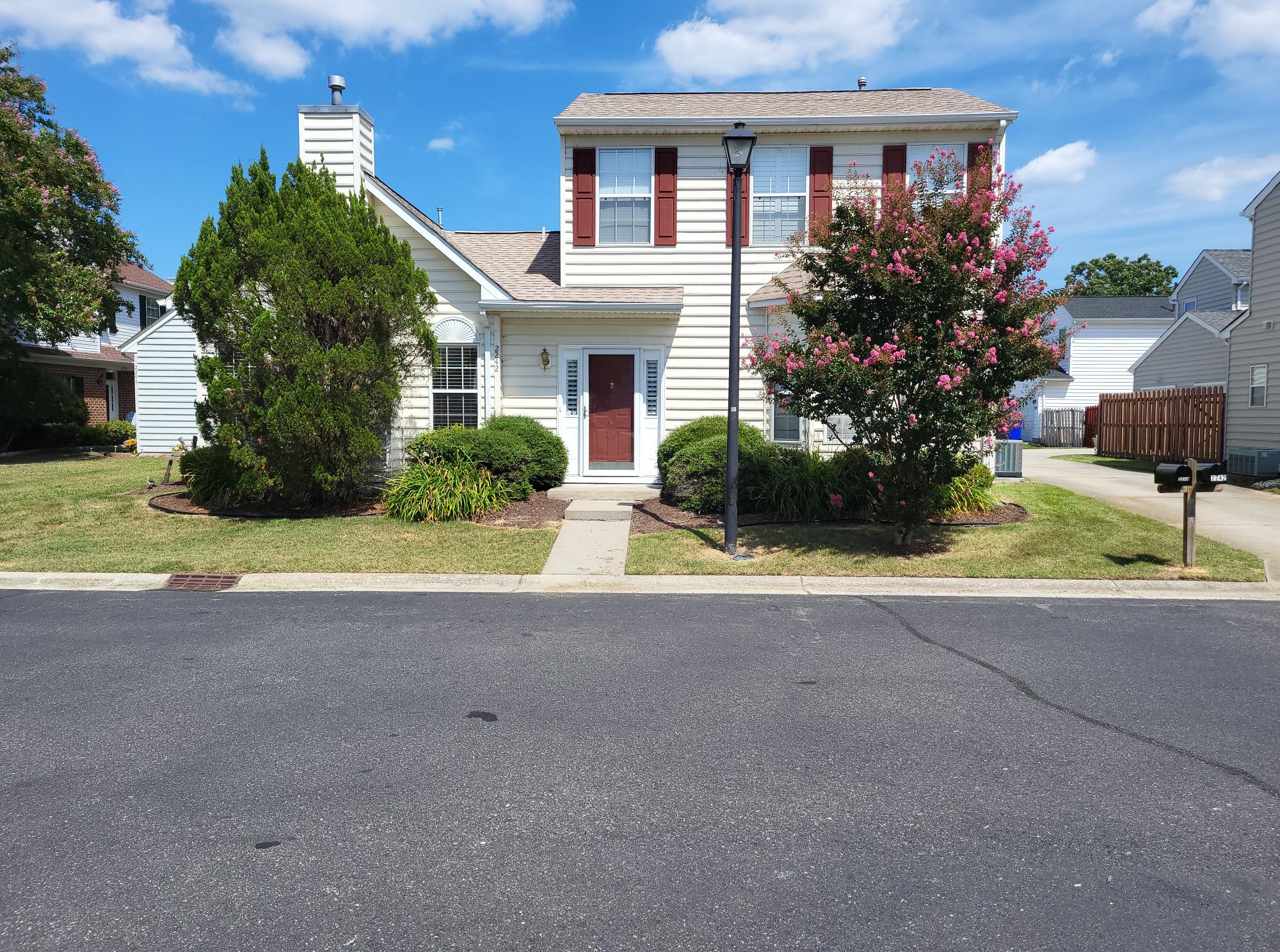
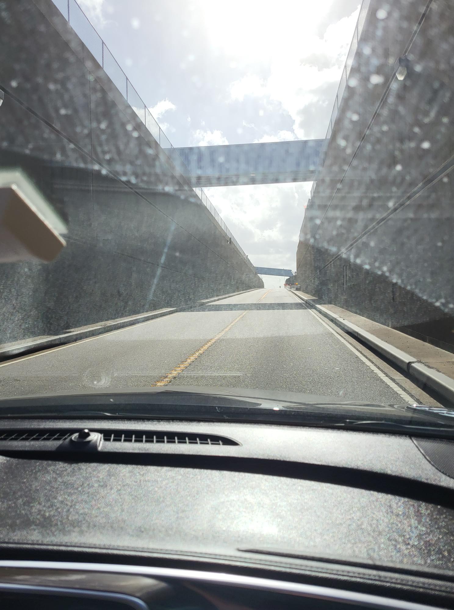


The above photos are of; our home in Newport News, the entrance to the HRBT tunnel, the GPS image of us underwater from our car and the Naval Station ships (aircraft carriers in this view) as we exited the HRBT.
Then on past that and into the Norfolk/Virginia Beach area, then to the US Route 13 North exit. After several city blocks on Route 13 we arrived at the Chesapeake Bay Bridge Tunnel Entrance booth. The day was very good for our day tour, sunny with light clouds, a decent temp in the low 70s and a slight breeze to keep us cool and dry. All in all, a great November day.
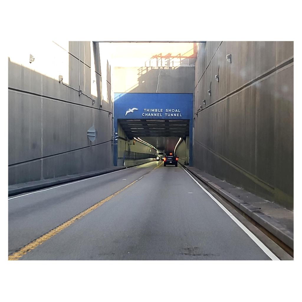
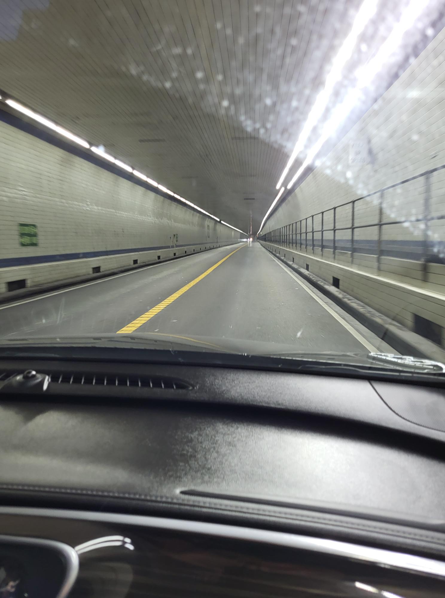
We entered the first of the tunnels and here is a photograph of the entrance to that tunnel.
Traveling on past the Kiptopeake National Preserve, we turned off 13 headed to the town of Cape Charles, a seaside village dating back to the 1700s. Definitely a place we will visit again. Especially to take a walk along the beach for that town. And perhaps we will rent one of the golf carts and travel all of the cart trails they have here.
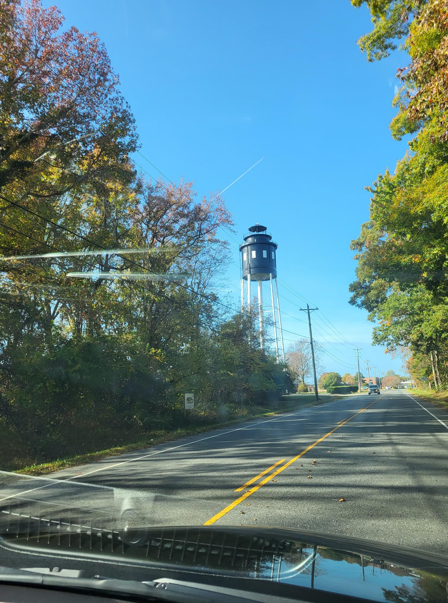
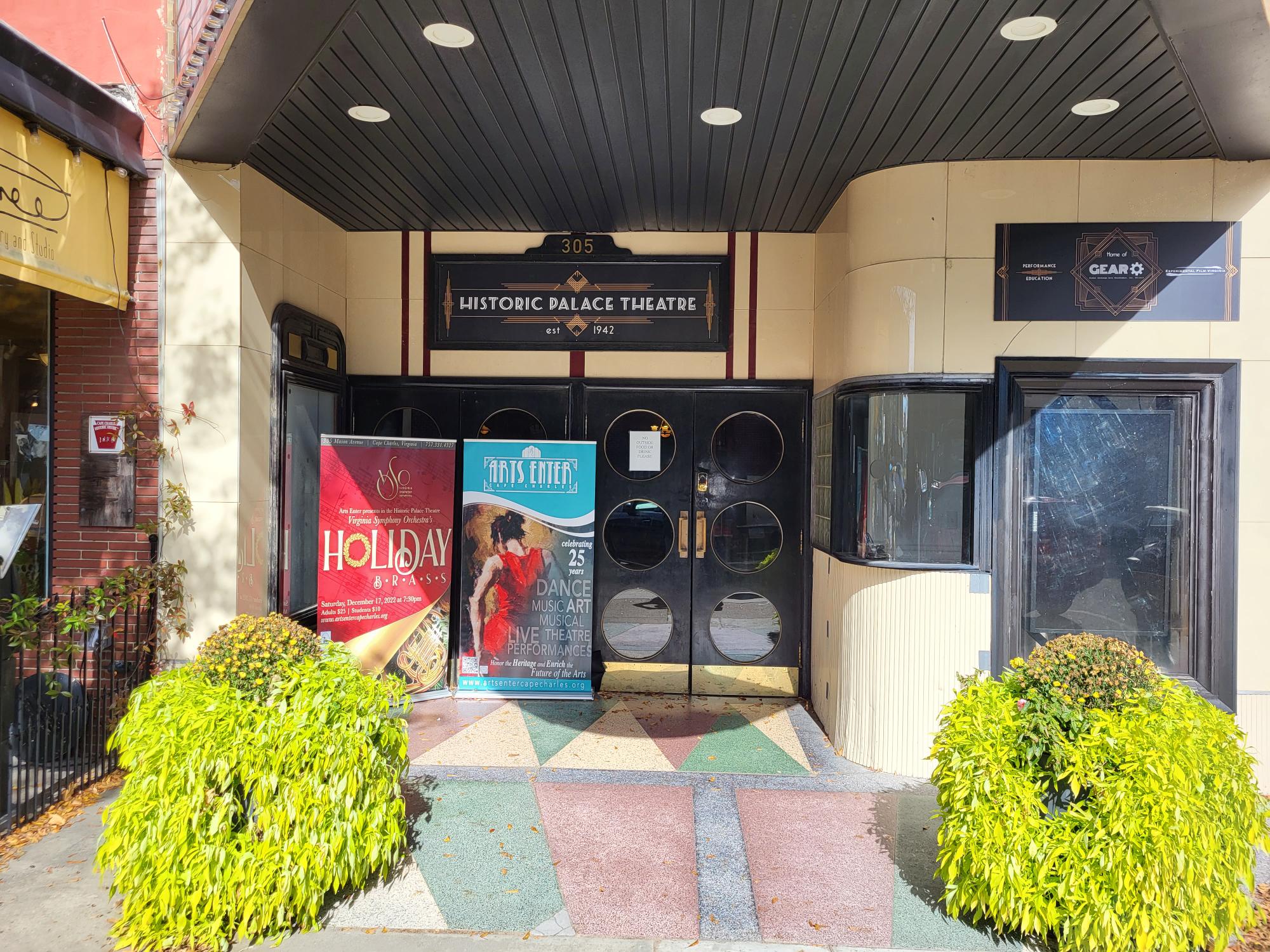
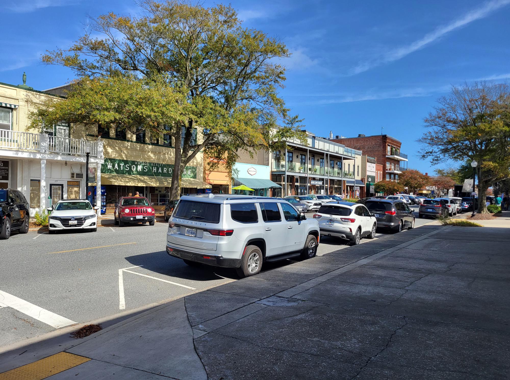
The photos above are a couple of shots we took of the Cape Charles township. The photo on the left is a picture of the town’s water tower, but they took some artistic license and made it look like an old Virginia light house. The upper picture on the right is a view of the entrance to the Historic Cape Charles Theater and the photo at the bottom right is a street scene of the main down town area for Cape Charles. All of the parking spaces on the opposite side of this street are required to be parked rear in rather than nose in.
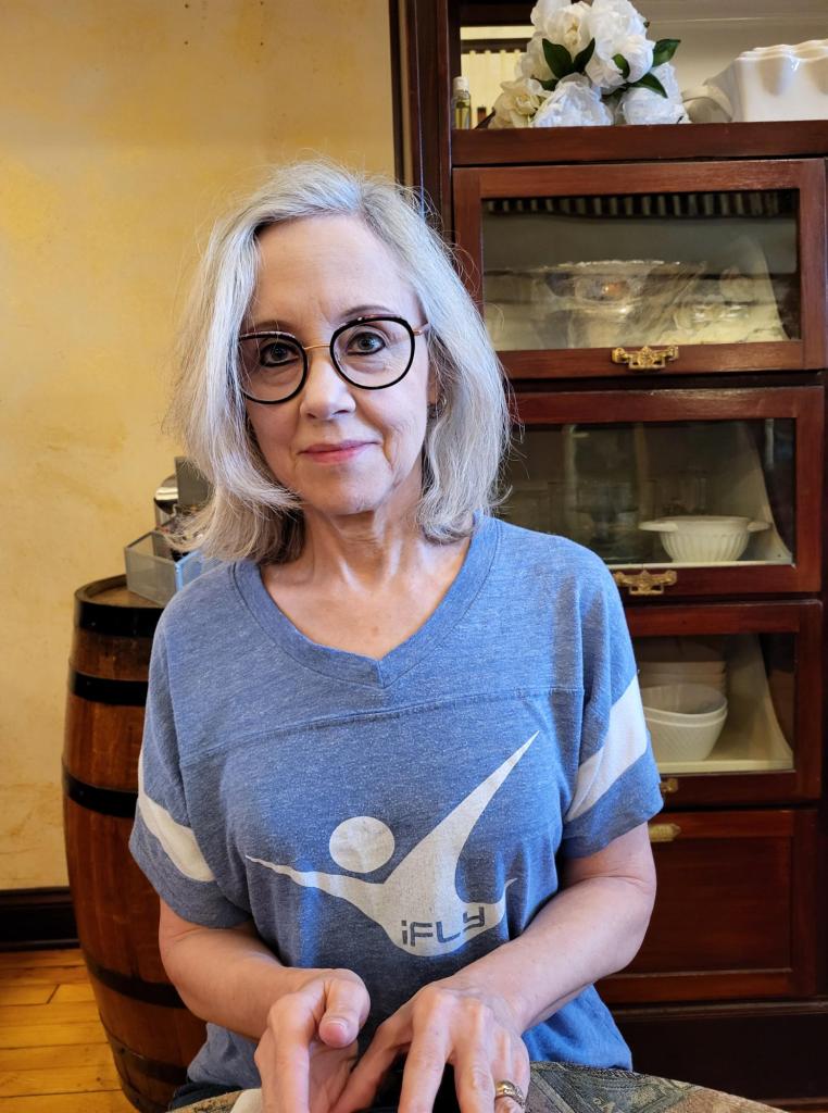
We enjoyed a very nice breakfast in Cape Charles in a restaurant that had been in operation for over 100 years. Good food, and friendly service. Below is a photo of my wife as we had breakfast. Just behind her was a large breakfront with some very old and really pretty antique glassware. The breakfront was a series of shelves with glass doors. A very nice antique, and probably extremely pricey.
The pictures below were taken as we left the area heading home. Another trip over the Chesapeake Bay Bridge Tunnel and the Hampton Roads Bridge Tunnel and then home to our beautiful neighborhood.
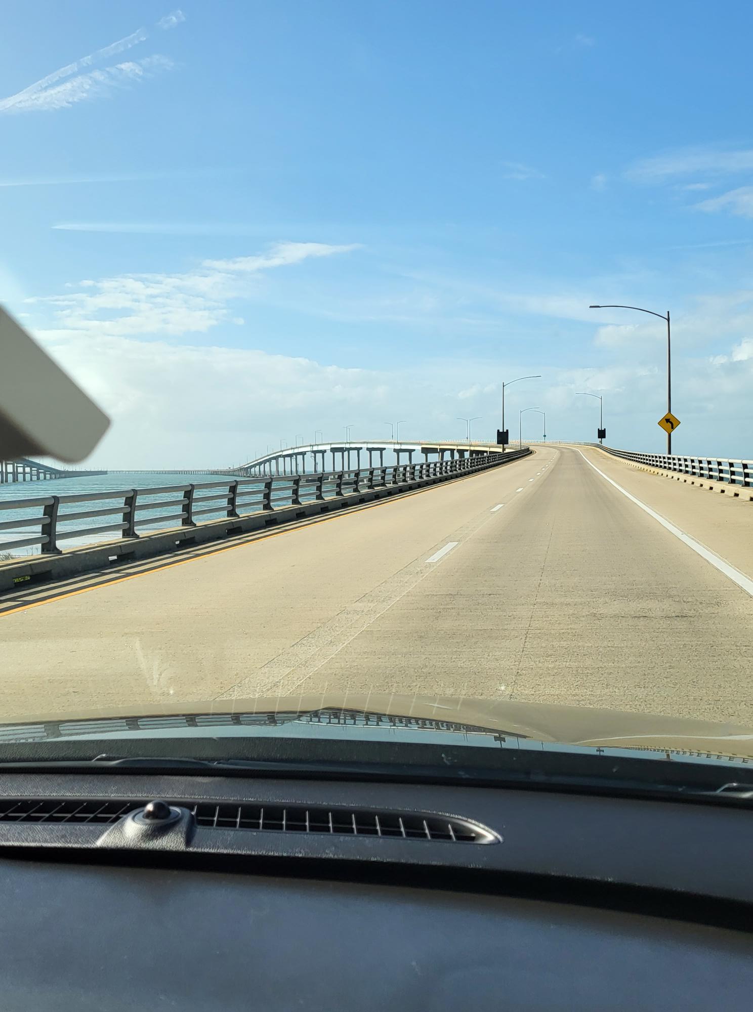
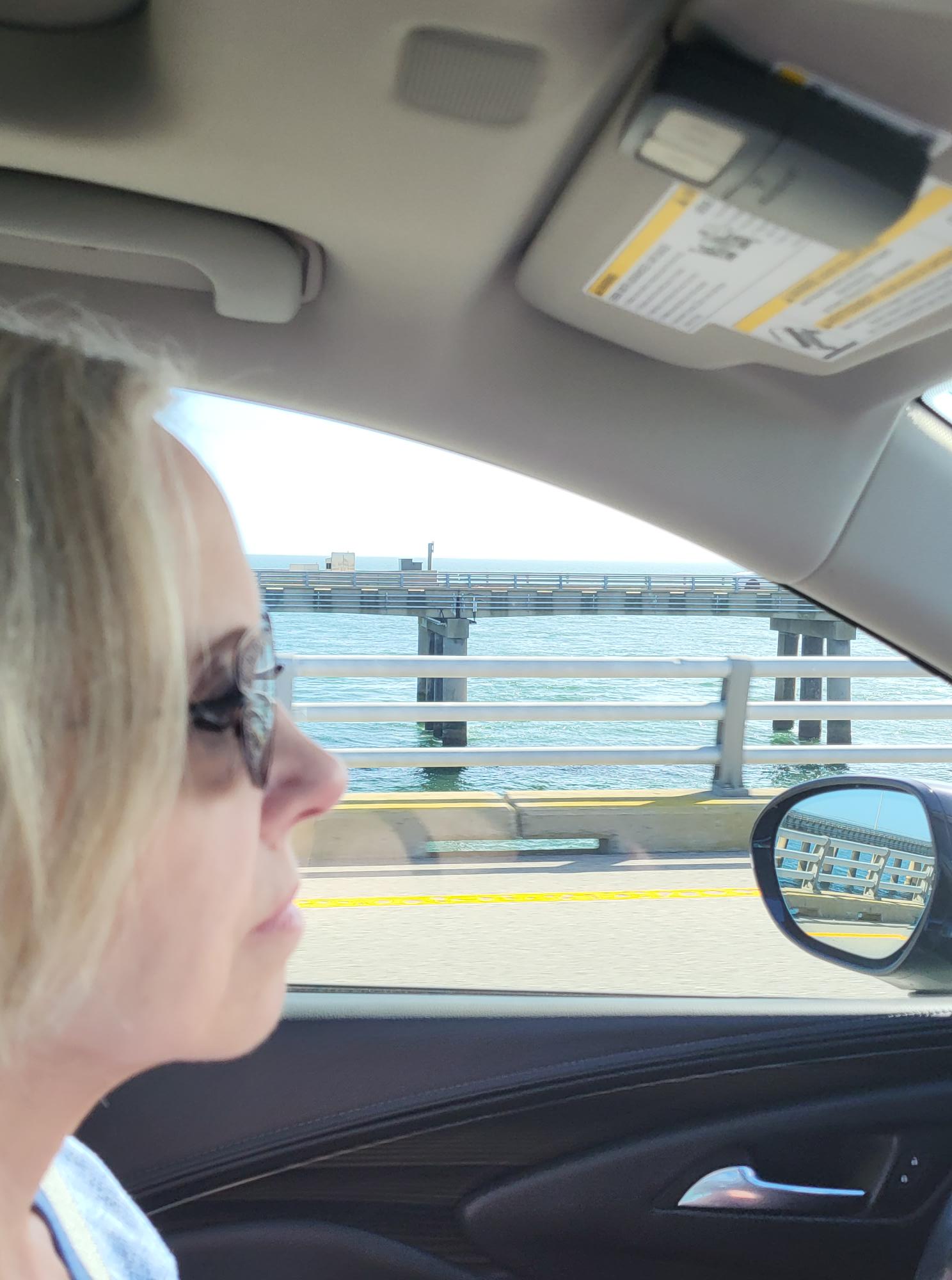
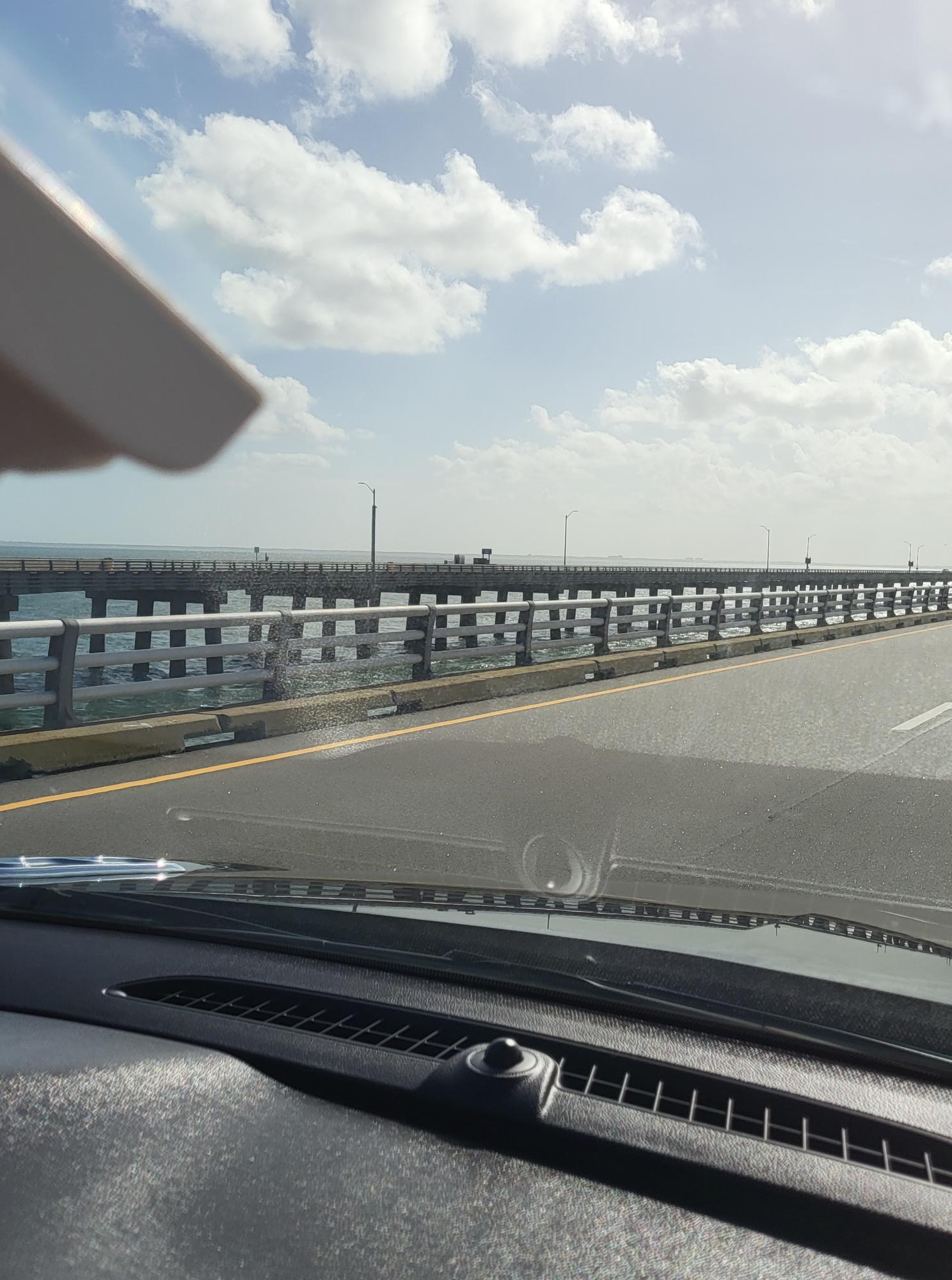

The photos above were taken as we headed home from our day trip to Cape Charles. The Picture in the upper right is taken of the twin bridges as they curved around to point toward the Virginia Beach area. The upper center photo is of my wife with a view of the Atlantic Ocean beyond her window. The shot in the upper right is a photo of the Virginia Beach coastline. We were still a bit too far out for it to be very clear. And the photo in the lower left is a shot of the cranes working on prep work for a second tunnel which will expand the traffic flow to single direction in each tunnel. Right now, the single existing tunnel had single lane traffic in both directions. Finally, the picture in the lower right is a shot of our ascent from the second tunnel and our final leg over the Chesapeake Bay Bridge Tunnel and onward to the “peninsula” which is what the locals refer to our home area.
The entire trip was a lot of fun, very interesting and filled with lots of great scenes. We will be making another visit to that area in the near future. Might wait until the Spring, however. That way we can really enjoy the walk about of this neat village, it’s beachfront and perhaps a few cart trails in a rental golf cart.
Keep watching. There’s a lot of neat things to see and do in our little corner of the USA and we plan on visiting as many as possible. Best thing it that the majority of the really interesting and historically prominent are within a very short drive. Lots of those things are right in our Hampton/Newport News area.
More to come!
